
If you look at a map of the United States, you might find yourself wondering what people were thinking when they were creating the shapes of some of the states. Here, there are straight lines; there, it’s all squiggly; and elsewhere, you’re not sure how to describe what you see.
Sometimes, how a state’s shape came to be makes perfect sense, and sometimes, there’s a more interesting story involved. Following are some interesting facts about the shapes and boundaries of some of our states.
1. Curving Boundaries
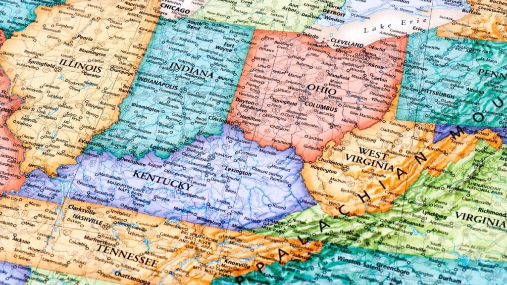
If you look at the 13 original states and many other Eastern and Midwestern states, you’ll see that they mostly have irregular shapes. That’s because the earlier states tended to be drawn along natural boundaries like rivers and ridges.
2. Straight Lines
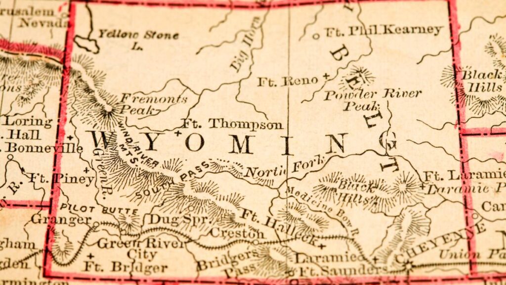
As America expanded westward, the federal government drew most state boundaries along lines of latitude and longitude. That’s why, with some exceptions, Western and some Midwestern states tend to look more rectangular and are roughly the same size.
Fun Fact: Colorado and Wyoming are two states that are almost perfect rectangles.
3. Railroads

During the period of railroad expansion, rail lines also played a role in boundary drawing. They often defined where one state ended and another began.
Did You Know? The boundary between Nevada and California was influenced by the route of the First Transcontinental Railroad.
4. The Erie Canal
In a similar way, the construction of the Erie Canal had an influence on the shapes of states. That was over a much smaller area, of course.
Fun Fact: The Erie Canal, completed in 1825, connected the Great Lakes to the Atlantic Ocean, boosting New York’s economy and influence.
5. The Oklahoma Panhandle
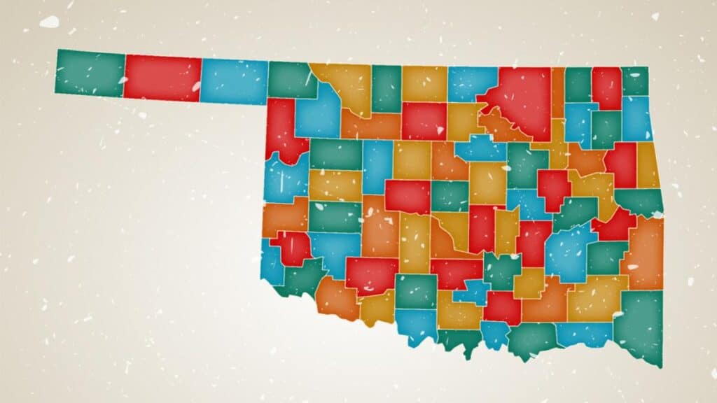
This is the sliver between Colorado and Texas. Why isn’t it part of one of those two? There’s a joke that Colorado asked not to share a border with Texas, but the reality has to do with slavery.
Texas wanted to join the union as a slave state, and at the time, federal law prohibited slavery above 36 degrees, 30 minutes north latitude. That happened to be the southern edge of what today is the Oklahoma Panhandle. Rather than not being able to join, Texas ceded its territory above that line.
Fun Fact: The Oklahoma Panhandle is 34 miles wide and 166 miles long, making it one of the most recognizable panhandles in the U.S.
6. The Northwest Angle, MN
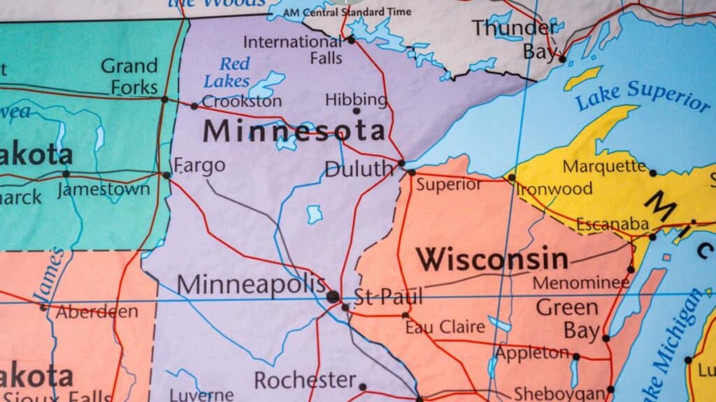
You might need a magnifying glass to see this, but on maps, a tiny bit of Minnesota juts north into Canada. Most of it is water, and without a boat, you actually have to drive into Canada to reach the “mainland.” What were they thinking? They really weren’t; it resulted from a survey error and should have been Canadian land.
7. Four Corners

This famous point is where Arizona, New Mexico, Colorado, and Utah all touch at a single point. There’s a marker there, and you can witness people contorting themselves into funny positions to get a part of their body touching all four states at once.
Even funnier: the real four corners is a few hundred yards away. Once again, a surveying error was responsible.
8. Point Roberts, WA

No accident was to blame for this one. When the U.S. and Canada were working out boundaries, they agreed to make this peninsula that’s actually attached to British Columbia part of Washington. Traveling there by car from the U.S. is only possible by driving through Canada.
Fun Fact: Residents of Point Roberts have to pass through two international border crossings if they wish to travel to the rest of Washington by land.
9. Madrid Bend, KY

In 1811 and 1812, earthquakes caused the Mississippi River to flow backward. As it did so, it cut off this small piece of Kentucky land, which is now on the Tennessee side of the river even though it’s still part of Kentucky.
10. Michigan’s Upper Peninsula

To scratch your head over this one, you won’t need a magnifying glass. Separated from the bulk of Michigan by Lake Michigan and Lake Huron, the Upper Peninsula, by logic, should be part of Wisconsin.
However, Michigan’s boundary follows the Montreal and Menominee Rivers as well as an imaginary line connecting them, and that line slices off the Upper Peninsula and makes it part of the Great Lakes State. At least you don’t have to go through another state or country to drive there, though, thanks to the Mackinac (ma-kuh-naw) Bridge.
Fun Fact: The Upper Peninsula, often called the “U.P.,” covers about 29% of Michigan’s land area but has only 3% of its population.
9 Signs You’re Smarter Than Average and Three Signs You’re Not

Do you think you’re smarter than most of the population? Check out these signs to see if you make the cut or if you should go back to school.
9 Signs You’re Smarter Than Average and Three Signs You’re Not
15 Fascinating Facts About Famous Landmarks Hardly Anyone Knows

There are countless iconic landmarks that dot the globe, each with its own unique story and significance. However, even the most famous of these landmarks harbor secrets and fascinating facts that are often overlooked. These 15 fascinating facts remind us that there’s always more to discover about the world’s most famous landmarks, no matter how well-known they may seem.
15 Fascinating Facts About Famous Landmarks Hardly Anyone Knows
Facts About the “Greatest Generation” That Prove How Much We Owe Them

Every generation leaves its mark on history, but the Greatest Generation—those who faced the challenges of the early 20th-century head-on—did more than just that. They carved out the world as we know it today. We owe them a lot, not just for their courage and resilience but for setting a precedent that still guides us when dealing with life’s obstacles.
Facts About the “Greatest Generation” That Prove How Much We Owe Them
Facts About America That Foreigners Find Unbelievable

For better or for worse, Americans are known for many things people from other countries find odd. Odd doesn’t necessarily mean bad, it just means, well, a bit hard to believe.
A Quora reader wrote, “What facts about the United States do foreigners not believe until they come to America? Rakib Islam continues, “I’m from Bangladesh, and here are a few things I find hard to explain to peeps back home.”
Facts About America That Foreigners Find Unbelievable
This article was produced by Our Woven Journey. Featured Image Credit: Budabar/Canva
Karee Blunt is a nationally syndicated travel journalist, focused on discovering destinations and experiences that captivate and inspire others through her writing. She is also the founder of Our Woven Journey, a travel site focused on inspiring others to create memory-making adventures with their loved ones. Karee is passionate about encouraging others to step out of their comfort zone and live the life they dream of. She is the mother of six kids, including four through adoption, and lives with her family in the Pacific Northwest. You can learn more about Karee on her about me page.